Most people who visit Paynes Prairie Preserve State Park are surprised to discover that a place labeled a prairie with herds of bison and horses roaming free is at times completely submerged by water. From 1871 to 1891, the water was deep enough to support travel by paddle-boat ferries. The prairie nearly became a permanent lake and was given the name Alachua Lake. But the lake has never been permanent due to the prairie’s geology.
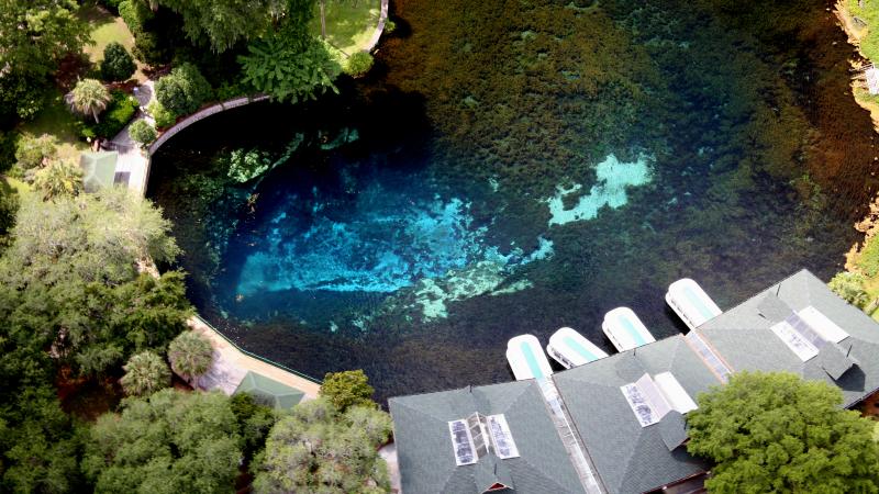
Separated from land surface by only 20 to 50 feet of clayey sands to sandy clays, limestone (called the Ocala Limestone) is near land surface at Paynes Prairie. Limestone is a sedimentary rock made up of calcium-carbonate, which comes from skeletal and algal fragments of marine organisms. As rainwater infiltrates into the subsurface, naturally occurring weak acids slowly dissolve the limestone. Once the water reaches the Ocala Limestone, it becomes part of the Floridan aquifer system, Florida’s primary source of drinking water.
Water prefers an unobstructed flow path, so it will travel along fractures and beds within the limestone, preferentially dissolving the rock. Over time, dissolution (a chemical process) will cause cavities to form within the limestone. When the cavities become large, the limestone’s ability to hold up the clayey sands and sandy clays above it is weakened. If the cavity collapses, a sinkhole is formed at land surface. This process forms a special topography called karst.
Landforms common in karst regions include sinkholes, caves, springs, and disappearing and reappearing streams. Peering north from the park’s observation tower at the visitor center, one will observe that the prairie is in part a marsh. The prairie’s topography is on average lower than the areas surrounding it. This is due to the dissolution of the Ocala Limestone below the prairie and the lands surrounding it containing thicker sequences of clay protecting limestones below from dissolution.
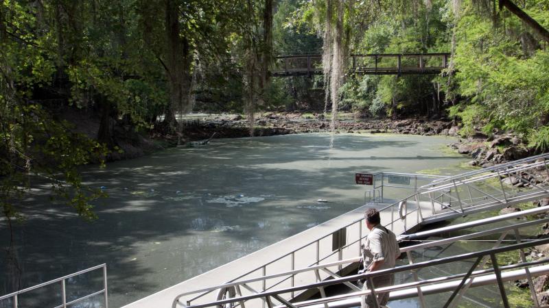
Traveling to the northside of the park, visitors can hike several trails, one of which (La Chua Trail) takes hikers by Alachua Sink.
Alachua Sink is a large sinkhole in the bottom of Paynes Prairie. The sinkhole is generally covered by water and not directly visible. Occasionally, however, sediments partially plugging the bottom of the sinkhole will unclog and flush most of Paynes Prairie’s marsh water into the subsurface. This scenario occurred in 1891, allowing bison and horses to roam the prairie.